Best driving roads near Dallas-Fort Worth
Dallas-Fort Worth sits on mostly flat prairie, so the roads with real hills start an hour or more out. Head west to the Palo Pinto Mountains, north to the Arbuckle Mountains in Oklahoma, or make a long day of the Talimena ridge road in the Ouachitas.
1. Talimena National Scenic Byway
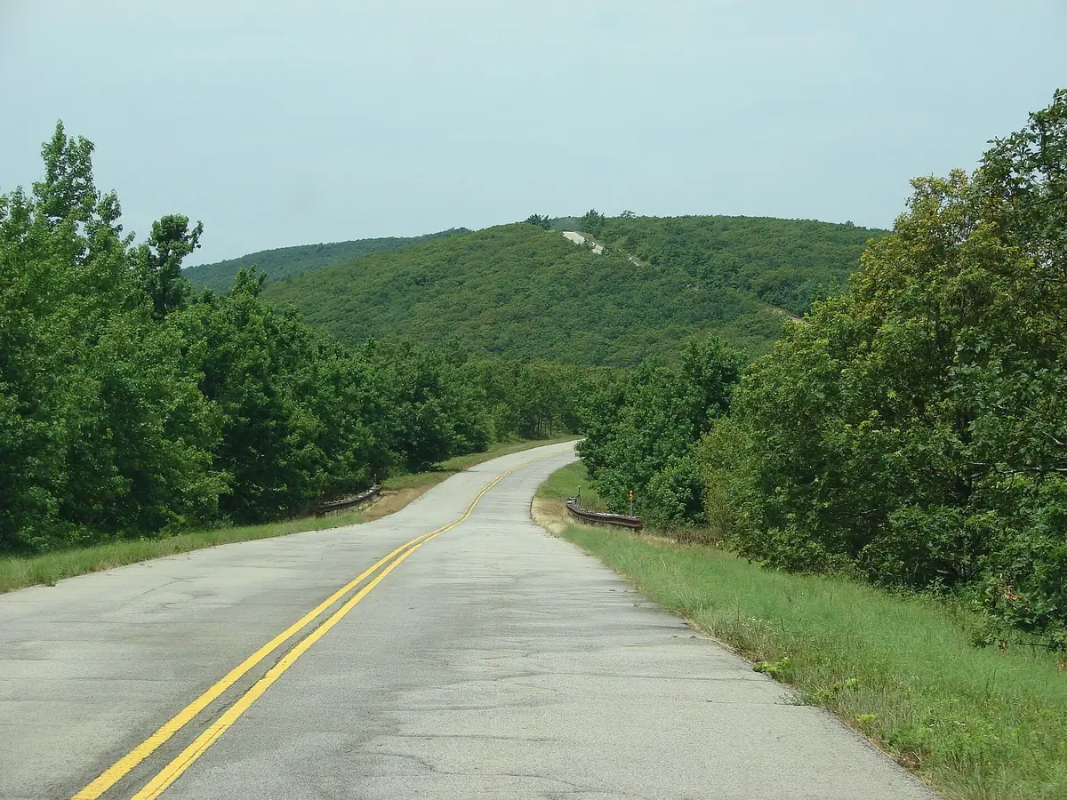

Two-lane ridge road across the Ouachita Mountains with 22 vista pull-outs. It is about 4 hours from Dallas, so make it a long day or a weekend.
The byway runs 54 miles on OK 1 and AR 88 between Talihina, Oklahoma, and Mena, Arkansas, inside the Ouachita National Forest. It follows the crests of Winding Stair Mountain and Rich Mountain, passing Queen Wilhelmina State Park and the Robert S. Kerr Arboretum.
Best time to go: Open year round.
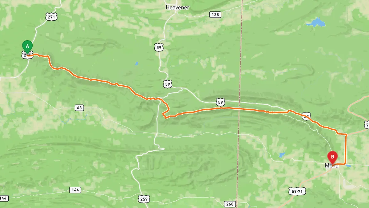
Sources: Length · High point · Best time. Along the way 1 · Along the way 2. Drive time is the route time for the mapped route without stops, from Mapbox.
2. US 77 through the Arbuckle Mountains
Two-lane US 77 with hairpin curves through the Arbuckle Mountains past Turner Falls.
North of Springer, US 77 drops to two lanes and climbs into the Arbuckle Mountains, a 1920s section with hairpin curves built with prison labor. It passes the entrance to Turner Falls Park, a 77 ft waterfall on Honey Creek, before reaching Davis.
Best time to go: Open all year; Turner Falls Park swimming season runs May 1 to September 30.
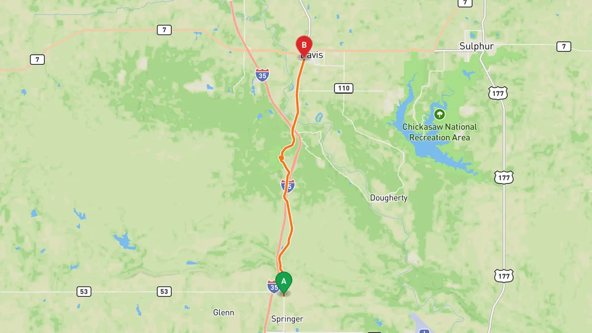
Sources: Best time. Along the way 1 · Along the way 2 · Along the way 3. Drive time is the route time for the mapped route without stops, from Mapbox.
3. FM 4 through the Palo Pinto Mountains
Farm road through the Palo Pinto Mountains between Granbury and Palo Pinto.
This section of FM 4 runs from Granbury northwest through Lipan and Santo to Palo Pinto, crossing the Palo Pinto Mountains between Santo and Palo Pinto. A motorcycle touring club has named the Palo Pinto to Granbury section one of the top ten roads in Texas for riding and scenery.
Best time to go: Open all year; no seasonal closures found.
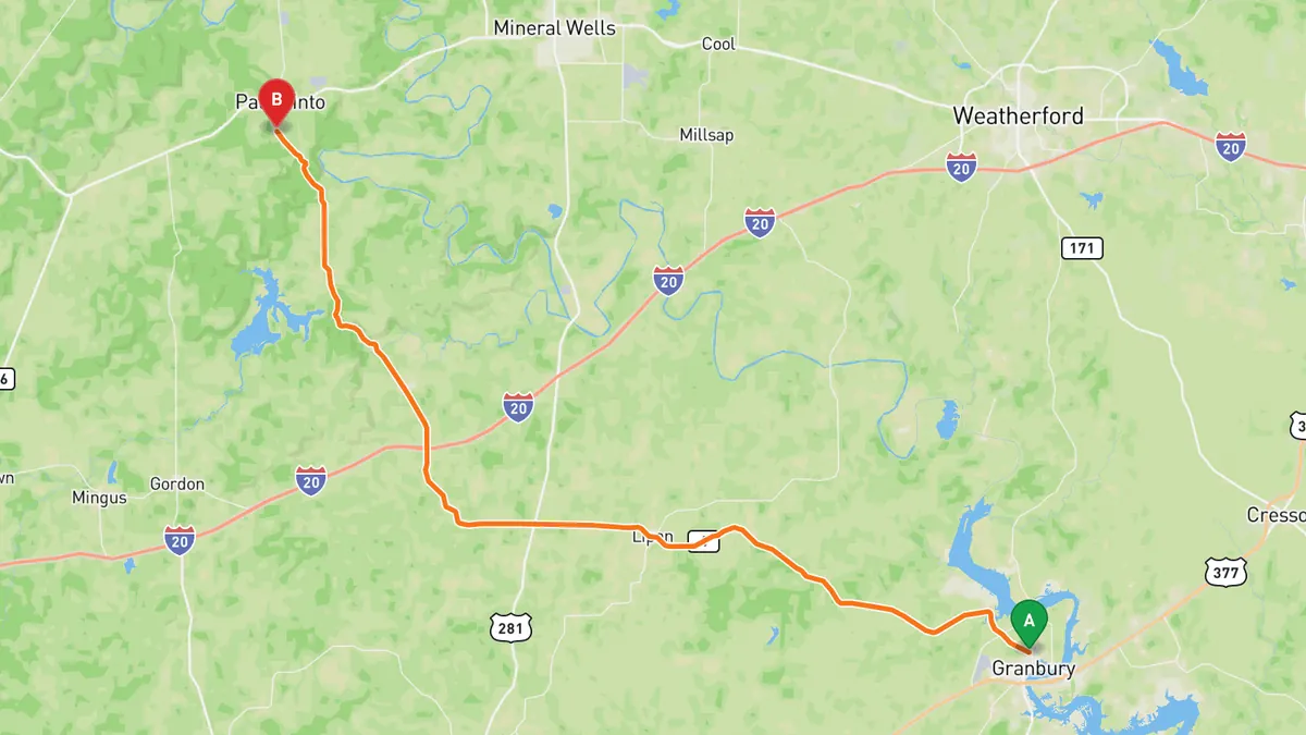
Sources: Along the way 1 · Along the way 2. Drive time is the route time for the mapped route without stops, from Mapbox.
4. US 67 and FM 205 to Glen Rose and Dinosaur Valley
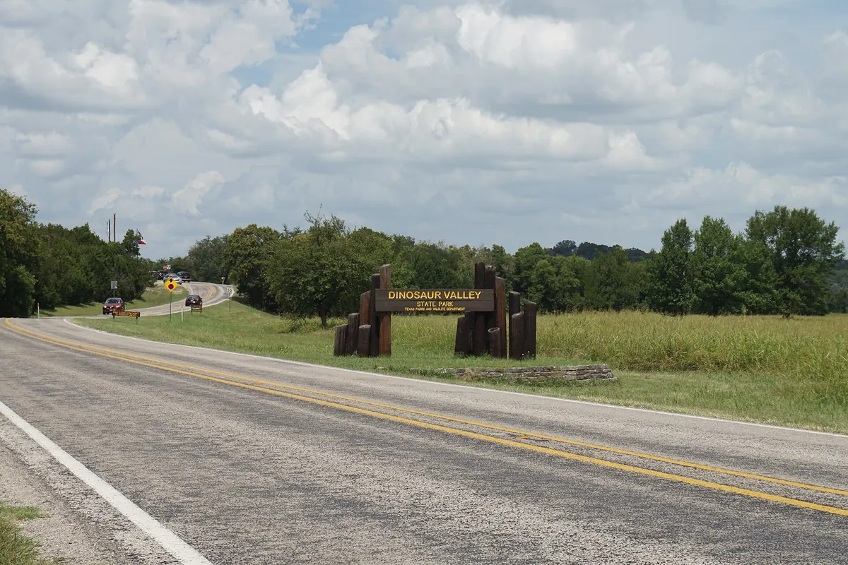

US 67 to Glen Rose, then FM 205 to Dinosaur Valley's riverbed tracks.
US 67 runs southwest from Cleburne to Glen Rose, the Somervell County seat, and FM 205 continues west from town to Park Road 59. Dinosaur Valley State Park sits on the Paluxy River, where 113 million year old theropod and sauropod tracks are in the riverbed.
Best time to go: Park open daily; dinosaur tracks are in the riverbed and not always visible, so check the park's track status first.
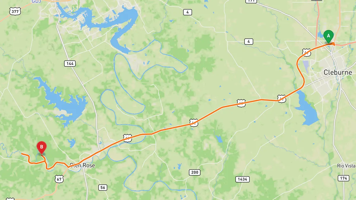
Sources: Best time. Along the way 1 · Along the way 2 · Along the way 3. Drive time is the route time for the mapped route without stops, from Mapbox.
5. SH 77S (Scenic Highway 77) at Lake Murray State Park
State highway along the west shore of Lake Murray, Oklahoma's largest state park.
The main SH 77S runs north from SH 32 near Marietta, along the west shore of Lake Murray inside Lake Murray State Park, and ends in Ardmore. The park was Oklahoma's first state park and is its largest, at about 12,500 acres, with Tucker Tower on the lake.
Best time to go: Park open daily for entry 7 a.m. to 11 p.m., all year.
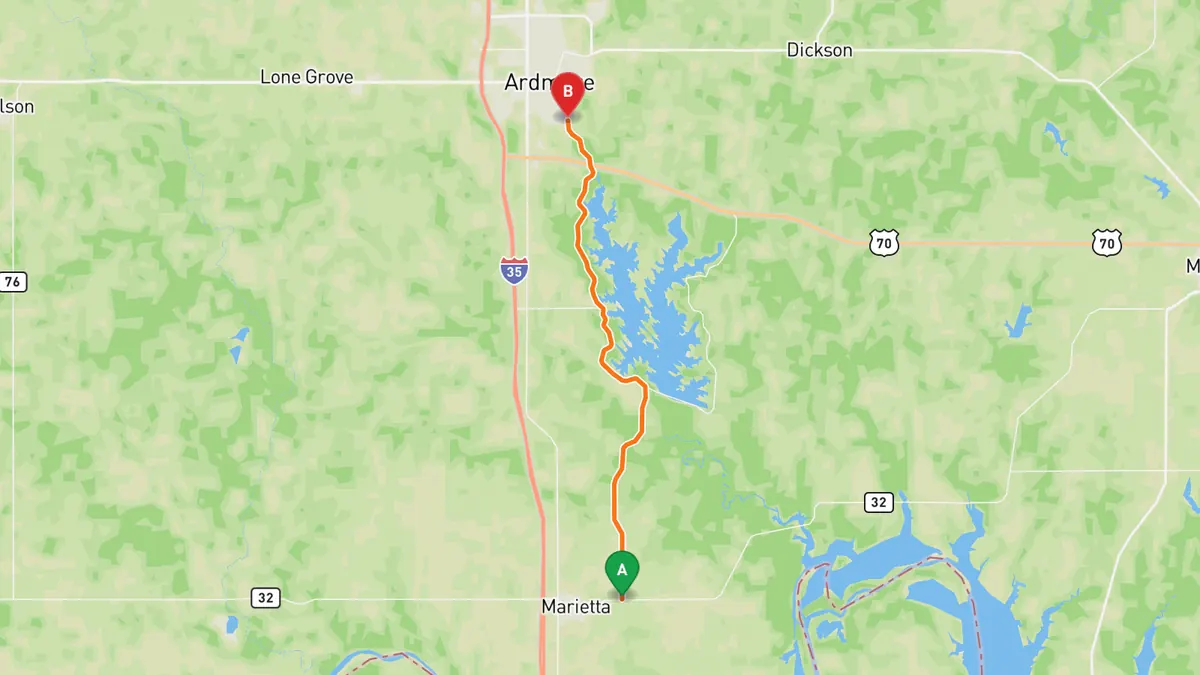
Sources: Length · Best time. Along the way 1 · Along the way 2 · Along the way 3. Drive time is the route time for the mapped route without stops, from Mapbox.
Track your next drive near Dallas-Fort Worth
Open Road keeps every drive: the route on a map, the time and the distance. On iPhone and Android.


Questions, answered
- What are the best driving roads near Dallas-Fort Worth?
- Top picks near Dallas-Fort Worth: Talimena National Scenic Byway, US 77 through the Arbuckle Mountains, FM 4 through the Palo Pinto Mountains, US 67 and FM 205 to Glen Rose and Dinosaur Valley, SH 77S at Lake Murray State Park. Each one is here for the drive and the scenery.
- How long are the best driving roads near Dallas-Fort Worth?
- Talimena National Scenic Byway: 54 miles. SH 77S at Lake Murray State Park: 17.6 miles (main route, SH 32 to Ardmore).
- Which driving road near Dallas-Fort Worth climbs the highest?
- Talimena National Scenic Byway, with a high point of 2,681 ft at Rich Mountain.
- When is the best time to drive these roads?
- Talimena National Scenic Byway: Open year round. US 77 through the Arbuckle Mountains: Open all year; Turner Falls Park swimming season runs May 1 to September 30. FM 4 through the Palo Pinto Mountains: Open all year; no seasonal closures found. US 67 and FM 205 to Glen Rose and Dinosaur Valley: Park open daily; dinosaur tracks are in the riverbed and not always visible, so check the park's track status first. SH 77S at Lake Murray State Park: Park open daily for entry 7 a.m. to 11 p.m., all year.
- What's the best app to track a drive near Dallas-Fort Worth?
- Open Road records your drive and saves it to your drive log with the route on a map, the distance and the time. It is on iPhone and Android.