Best driving roads near Tampa
Tampa Bay is flat, and its drives are bridges and causeways over open water plus the beach road on the Gulf barrier islands. For a longer day, SR 24 runs north of the bay to the small island town of Cedar Key.
1. Sunshine Skyway Bridge (I-275)
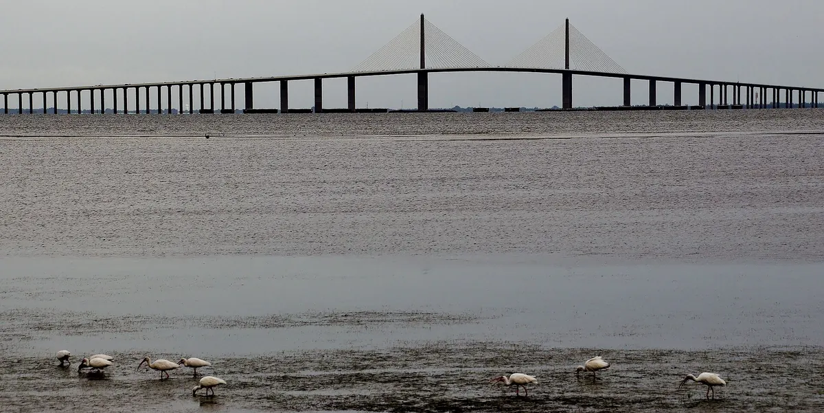

Cable-stayed span over lower Tampa Bay with 181 ft of ship clearance.
I-275 and US 19 leave St. Petersburg and cross lower Tampa Bay on long beam bridges either side of a tall cable-stayed main span. The road lands in Manatee County near Terra Ceia.
Best time to go: Open year round. Check FL511 before you go during hurricane season, June 1 to November 30.
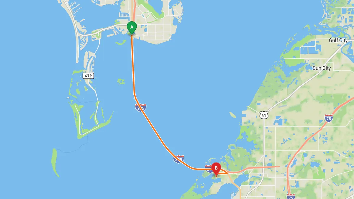
Sources: Length · Best time. Along the way. Drive time is the route time for the mapped route without stops, from Mapbox.
2. Courtney Campbell Causeway (SR 60)
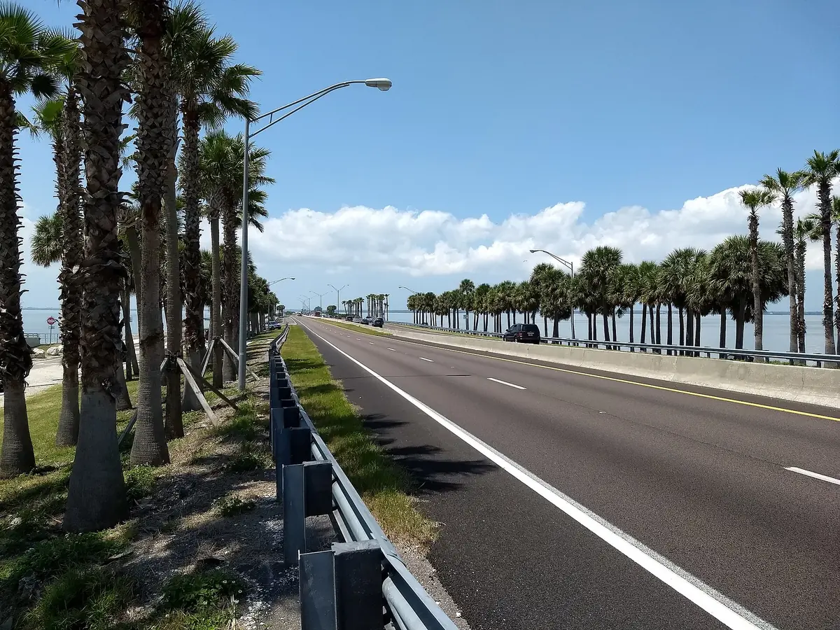

SR 60 runs low across Old Tampa Bay between Clearwater and Tampa.
SR 60 crosses Old Tampa Bay on the causeway from eastern Clearwater to Rocky Point island and on to the mainland of western Tampa. It is the northernmost crossing of Old Tampa Bay and has a paved trail alongside.
Best time to go: Open year round. Check FL511 before you go during hurricane season, June 1 to November 30.
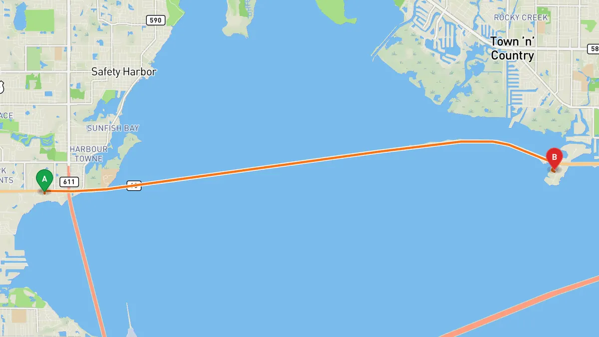
Sources: Length · Best time. Along the way. Drive time is the route time for the mapped route without stops, from Mapbox.
3. Gulf Boulevard (SR 699), Pinellas beaches
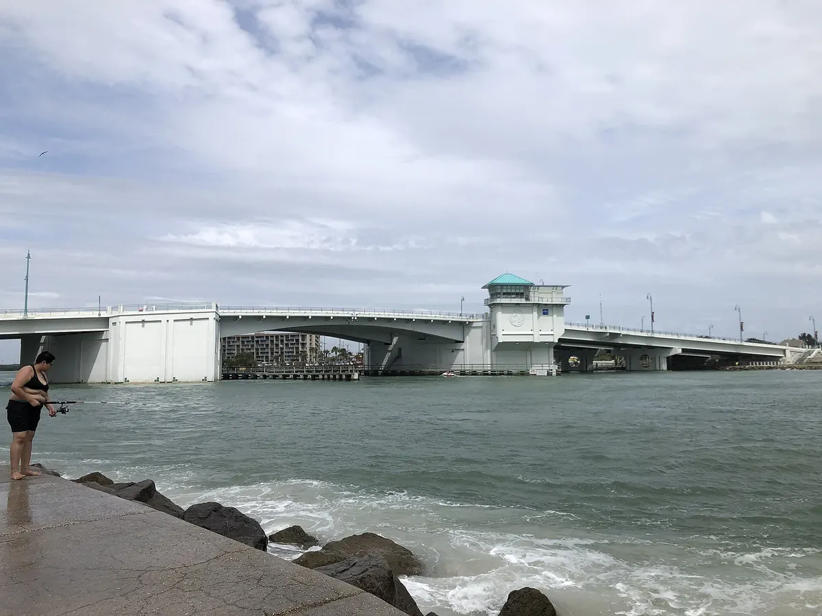

Beach-town road along the Pinellas barrier islands, over the John's Pass drawbridge.
SR 699, known as Gulf Boulevard and Blind Pass Road, runs 15 miles up the Pinellas County barrier islands from the Pinellas Bayway in St. Pete Beach to Indian Rocks Beach. It crosses John's Pass on a drawbridge between Treasure Island and Madeira Beach.
Best time to go: Open year round. Check FL511 before you go during hurricane season, June 1 to November 30.
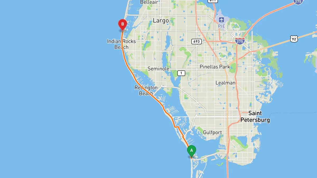
Sources: Length · Best time. Along the way. Drive time is the route time for the mapped route without stops, from Mapbox.
4. Pinellas Bayway to Fort De Soto Park (SR 682 / SR 679)
Bayway bridges and causeways out to the five islands of Fort De Soto Park.
The Pinellas Bayway (SR 682) leaves St. Petersburg near I-275 and crosses the entrance of Boca Ciega Bay to Isla del Sol, where SR 679 turns south over two bridges to Tierra Verde. The two-lane southern half ends in Fort De Soto Park, 1,136 acres on five connected islands.
Best time to go: Open year round. Check Pinellas County park updates before you go.
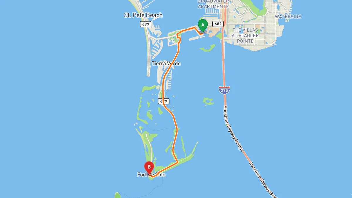
Sources: Length · Best time. Along the way 1 · Along the way 2. Drive time is the route time for the mapped route without stops, from Mapbox.
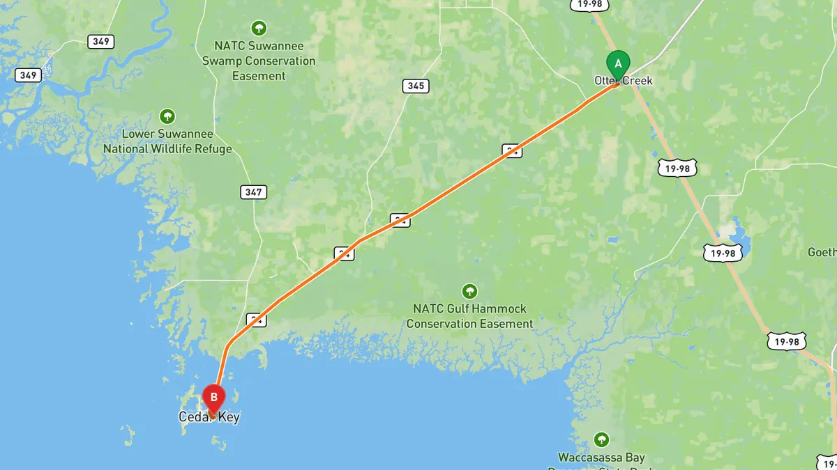
5. SR 24 to Cedar Key
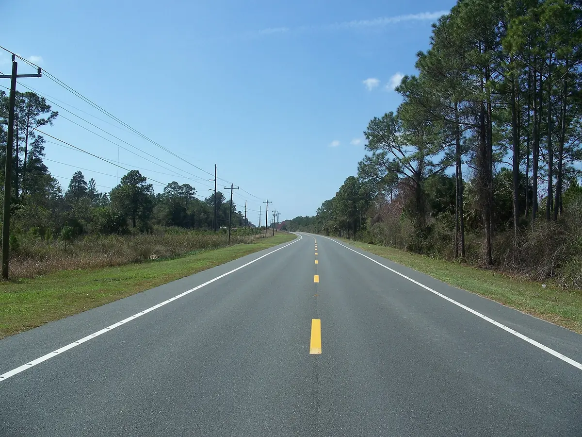

Two-lane road through wildlife lands, island-hopping into the Gulf town of Cedar Key. It is about 2 h 20 min from Tampa to the Otter Creek start, so make it a long day.
SR 24 leaves US 19 at Otter Creek and heads southwest through Rosewood, running between the Cedar Keys National Wildlife Refuge and Waccasassa Bay Preserve State Park. It skips over Jackson Island and Sunset Island before ending as D Street in Cedar Key.
Best time to go: Open year round. Check FL511 before you go during hurricane season, June 1 to November 30.
Sources: Best time. Along the way. Drive time is the route time for the mapped route without stops, from Mapbox.
Track your next drive near Tampa
Open Road keeps every drive: the route on a map, the time and the distance. On iPhone and Android.


Questions, answered
- What are the best driving roads near Tampa?
- Top picks near Tampa: Sunshine Skyway Bridge, Courtney Campbell Causeway, Gulf Boulevard, Pinellas beaches, Pinellas Bayway to Fort De Soto Park, SR 24 to Cedar Key. Each one is here for the drive and the scenery.
- How long are the best driving roads near Tampa?
- Sunshine Skyway Bridge: 4.14 miles. Courtney Campbell Causeway: 9.9 miles, Clearwater to Tampa. Gulf Boulevard, Pinellas beaches: 15 miles. Pinellas Bayway to Fort De Soto Park: 9.96 miles on SR 679.
- When is the best time to drive these roads?
- Sunshine Skyway Bridge: Open year round. Check FL511 before you go during hurricane season, June 1 to November 30. Courtney Campbell Causeway: Open year round. Check FL511 before you go during hurricane season, June 1 to November 30. Gulf Boulevard, Pinellas beaches: Open year round. Check FL511 before you go during hurricane season, June 1 to November 30. Pinellas Bayway to Fort De Soto Park: Open year round. Check Pinellas County park updates before you go. SR 24 to Cedar Key: Open year round. Check FL511 before you go during hurricane season, June 1 to November 30.
- What's the best app to track a drive near Tampa?
- Open Road records your drive and saves it to your drive log with the route on a map, the distance and the time. It is on iPhone and Android.