Best driving roads near Houston
The Houston area is flat coastal plain, so these drives are about scenery, not hills. The picks are the Gulf shore on Galveston Island and the Bolivar Peninsula, pine forest to the north, and Washington County farm roads in bluebonnet season.
1. Seawall Boulevard, Galveston
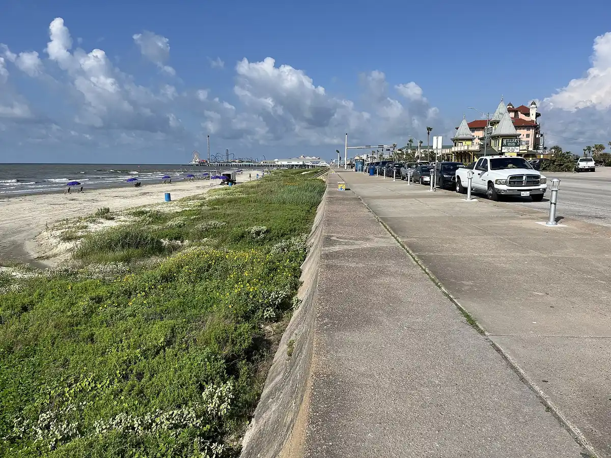

Ten miles of Gulf beachfront beside the Galveston Seawall.
Seawall Boulevard runs along the Gulf side of Galveston Island next to the Galveston Seawall, from the east end of the island near SH 87 west past the Pleasure Pier and Hotel Galvez. West of 61st Street it carries FM 3005.
Best time to go: Open all year.
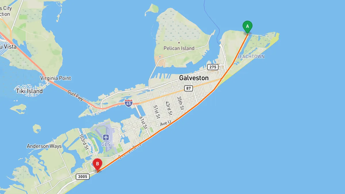
Sources: Length. Along the way 1 · Along the way 2. Drive time is the route time for the mapped route without stops, from Mapbox.
2. TX 87 on the Bolivar Peninsula
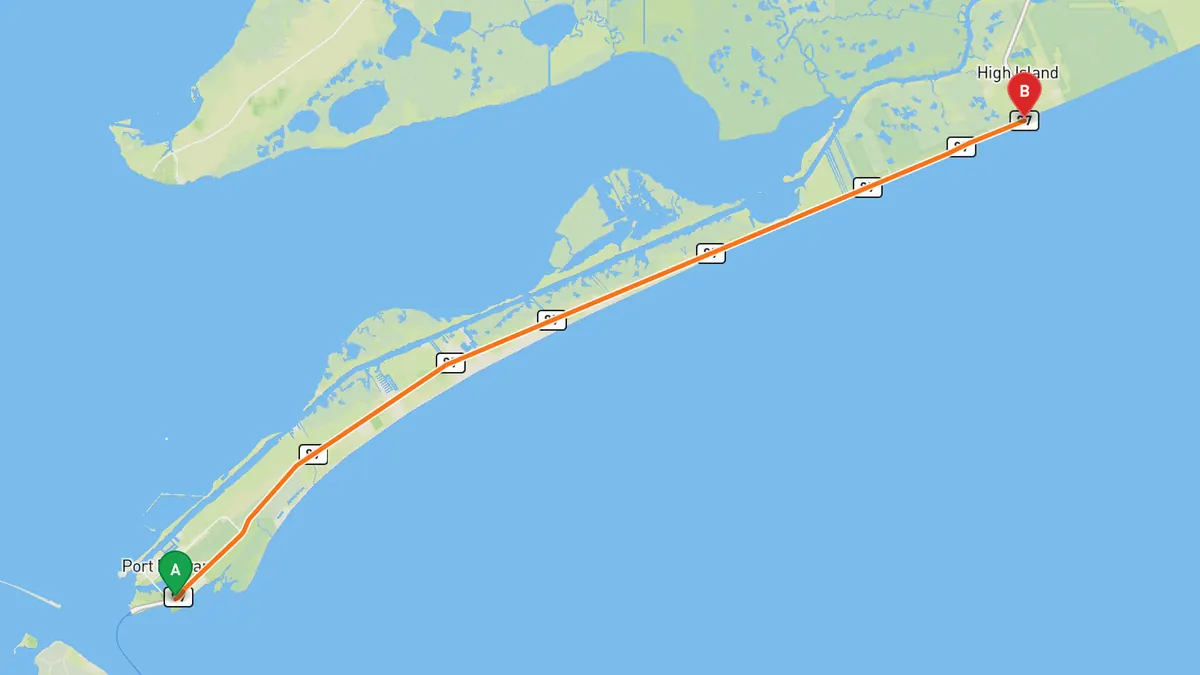
Ferry from Galveston, then TX 87 along 27 miles of Gulf beachfront.
From the ferry landing at Port Bolivar, TX 87 runs northeast along the narrow peninsula between Galveston Bay and the Gulf, through Crystal Beach and Gilchrist. It ends the peninsula run at High Island; the stretch of TX 87 beyond, toward Sea Rim State Park, has been closed since 1990.
Best time to go: All year; the Galveston-Port Bolivar ferry runs 24 hours a day, 365 days a year, weather permitting.
Sources: Length · Best time. Along the way 1 · Along the way 2 · Along the way 3. Drive time is the route time for the mapped route without stops, from Mapbox.
3. FM 390 through Washington County
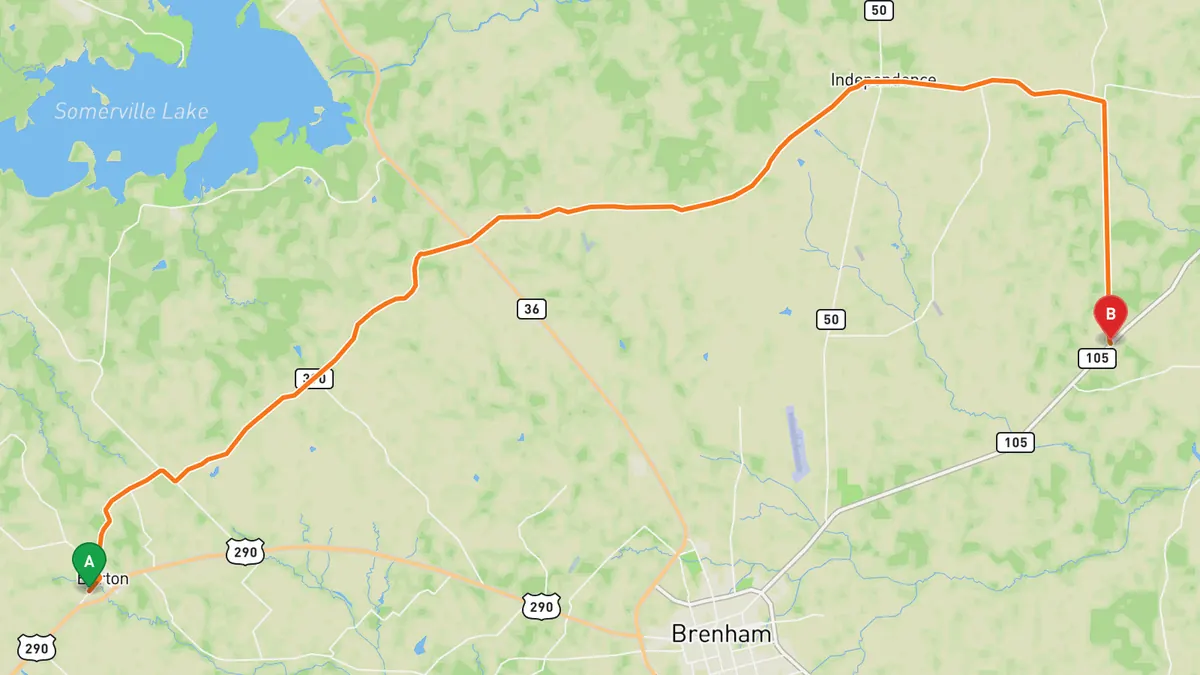
Farm road on the old La Bahia Road through Washington County bluebonnet country.
FM 390 runs from US 290 at Burton northeast through Gay Hill and Independence to William Penn, then south to SH 105 northeast of Brenham. Much of it follows the old La Bahia Road, and a spur at Independence leads to the ruins of the original Baylor University campus.
Best time to go: Spring, when bluebonnets peak late March to mid-April; other wildflowers bloom for a few months after.
Sources: Length · Best time. Along the way 1 · Along the way 2. Drive time is the route time for the mapped route without stops, from Mapbox.
4. FM 1375 through Sam Houston National Forest
Through Sam Houston National Forest to Lake Conroe at Cagle Recreation Area.
FM 1375 runs west from New Waverly on I-45 through Sam Houston National Forest, passing the Kelly Pond trailhead and Cagle Recreation Area on Lake Conroe. West of the lake it ends at FM 149.
Best time to go: All year; redbuds bloom in mid February and dogwoods in early March near Cagle on FM 1375.
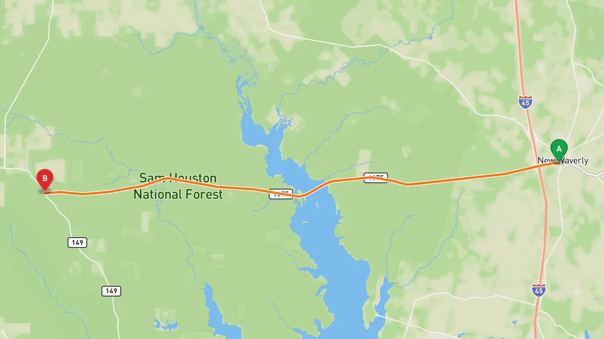
Sources: Best time. Along the way 1 · Along the way 2. Drive time is the route time for the mapped route without stops, from Mapbox.
5. FM 3005 to San Luis Pass, Galveston Island
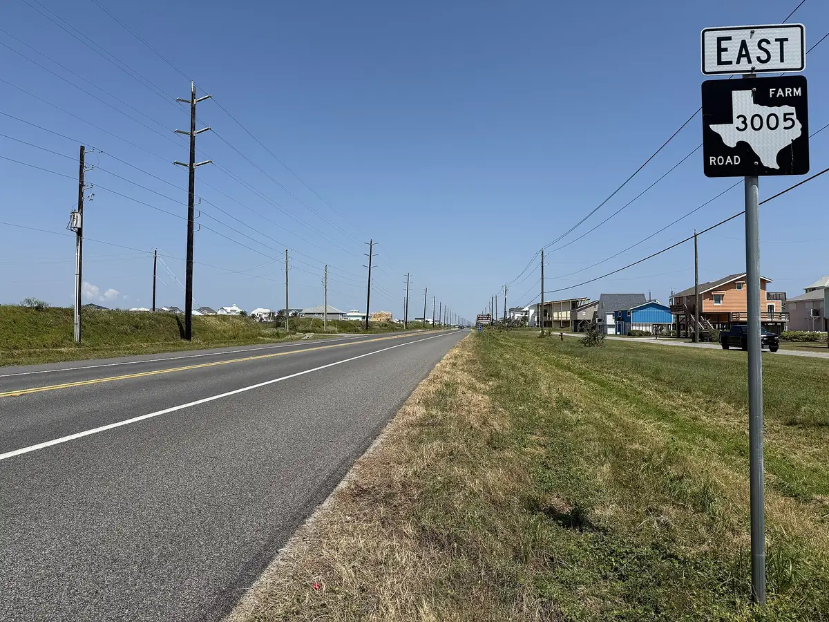

Island road past Galveston Island State Park to the San Luis Pass bridge.
FM 3005 starts at 61st Street in Galveston, runs west along Seawall Boulevard, then follows Termini-San Luis Pass Road down the island through Jamaica Beach and Galveston Island State Park. It ends at the approach to the San Luis Pass bridge, which crosses to the Bluewater Highway in Brazoria County.
Best time to go: Open all year.
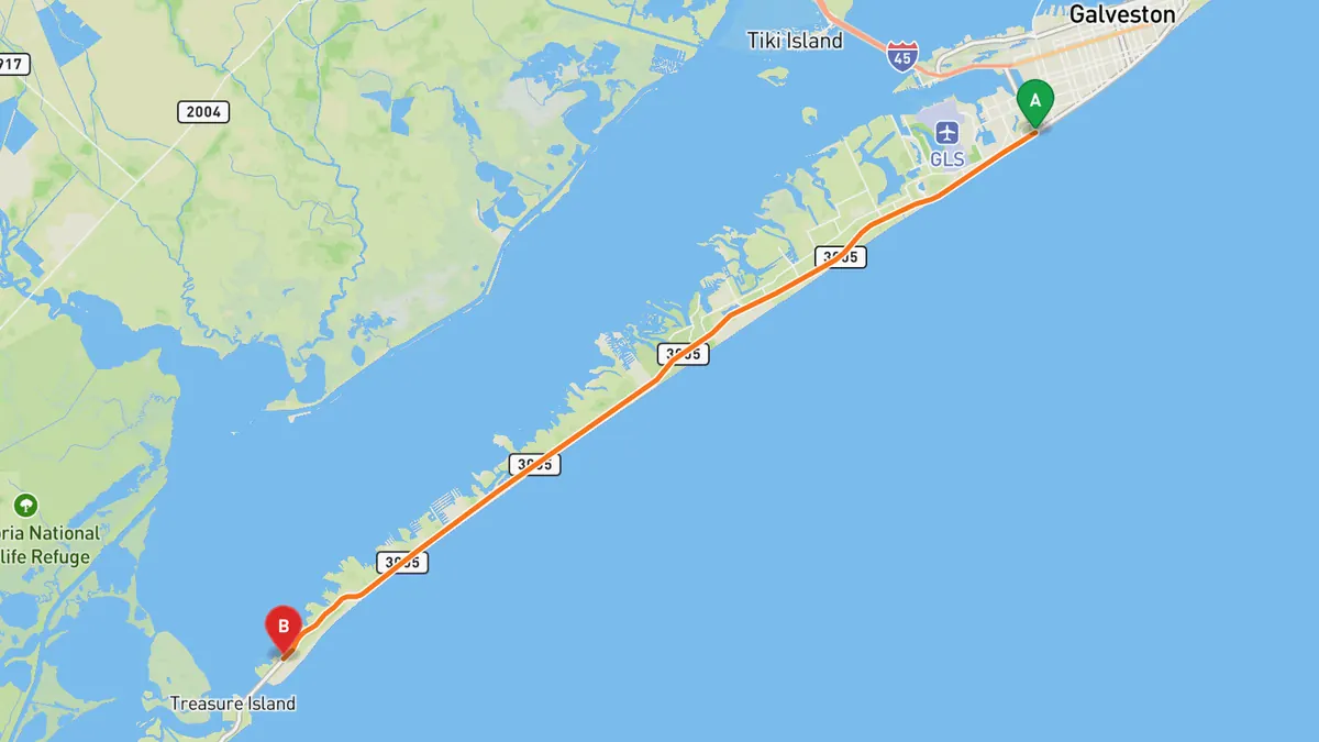
Sources: Length. Along the way. Drive time is the route time for the mapped route without stops, from Mapbox.
Track your next drive near Houston
Open Road keeps every drive: the route on a map, the time and the distance. On iPhone and Android.


Questions, answered
- What are the best driving roads near Houston?
- Top picks near Houston: Seawall Boulevard, Galveston, TX 87 on the Bolivar Peninsula, FM 390 through Washington County, FM 1375 through Sam Houston National Forest, FM 3005 to San Luis Pass, Galveston Island. Each one is here for the drive and the scenery.
- How long are the best driving roads near Houston?
- Seawall Boulevard, Galveston: about 10 miles, the length of the seawall sidewalk beside it. TX 87 on the Bolivar Peninsula: about 27 miles, the length of the peninsula. FM 390 through Washington County: 29.6 miles. FM 3005 to San Luis Pass, Galveston Island: 22 miles.
- When is the best time to drive these roads?
- Seawall Boulevard, Galveston: Open all year. TX 87 on the Bolivar Peninsula: All year; the Galveston-Port Bolivar ferry runs 24 hours a day, 365 days a year, weather permitting. FM 390 through Washington County: Spring, when bluebonnets peak late March to mid-April; other wildflowers bloom for a few months after. FM 1375 through Sam Houston National Forest: All year; redbuds bloom in mid February and dogwoods in early March near Cagle on FM 1375. FM 3005 to San Luis Pass, Galveston Island: Open all year.
- What's the best app to track a drive near Houston?
- Open Road records your drive and saves it to your drive log with the route on a map, the distance and the time. It is on iPhone and Android.